Orlando International Airport (MCO)
Orientation and Maps
(Orlando, Florida (FL), USA)
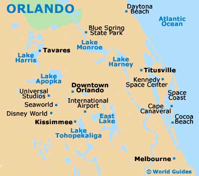
Home to Florida's most famous vacation resort, Orlando is best known for being home to the enormous Walt Disney World (WDW), but there really is much more to the city the Mickey Mouse. Away from all the tourism, castles and rollercoasters and theme-park attractions, Orlando features a series of small and charming towns, a number of large lakes and even some springs suitable for swimming.
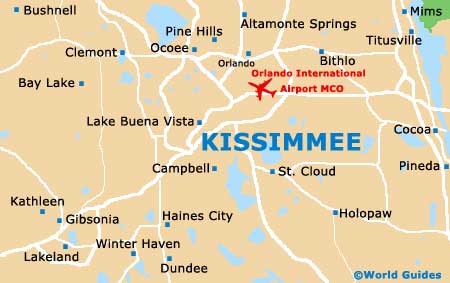
Orlando International Airport (MCO) is the city's biggest and busiest airport, after both the Sanford Airport (SFB) and nearby Executive Airport (ORL). Located on the southern side of the city, Orlando International Airport is a vast complex and stands next to the Martin Anderson Expressway / Bee Line Expressway US-528.
Orlando International Airport (MCO) Maps: Important City Districts
Public transportation within the city is good and local buses are run by the Lynx Bus System. Long-distance buses are also available, with the Greyhound bus station located along the North John Young Parkway and serving a number of prominent cities in Florida, such as Jacksonville, Miami and Tampa.
The main north to south artery in the city is the I-4 interstate, connecting many popular parts of Orlando, such as Lake Ivanhoe, Lake Concord and Lake Holden. Many nearby towns and cities also lie off the I-4, including Daytona to the east, and Tampa to the west.
Maps of the city, general up-to-date tourist information and leaflets are available at the Orlando Visitors Bureau along International Drive. You will also find many of the city's hotels along International Drive, together with vast shopping malls and restaurants. Downtown Orlando tends to be a much more reserved and quiet affair, being frequented mainly by locals.
USA Map
Florida Map

Orlando Map